|
|
 |
|
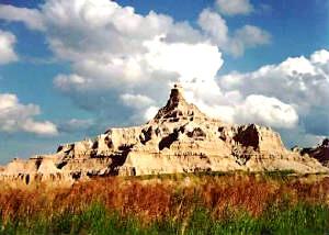
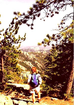
Pinacles Overlook- Bandlands Nat'l Park
Cedar Pass-Badlands National Park, SD
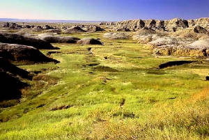
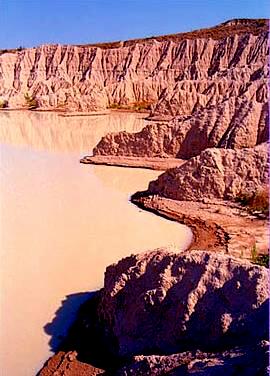
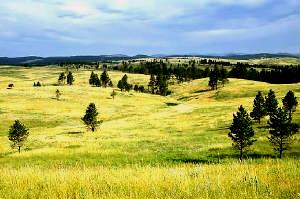
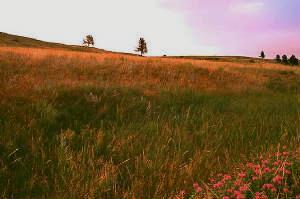
Yellow Mounds Prairie-- Badlands, SD
Stonghold Table, SD (southern unit)
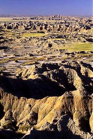
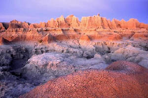
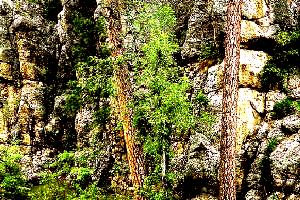
Badlands Formation, SD
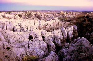
Eastern Ridge Badlands, SD
Sheep Mountain Table--Badlands, SD
|
BADLANDS, SOUTH DAKOTA
The Western part of South Dakota is a revered gateway between the Black Hills and the vast open prairie. At one
time millions of bison roamed the prairie and provided sustenance to the Native Americans. The buffalo was the most
sacred animal to the tribes of the Central Plains. Every part of the animal was untilized from the meat for protein,
blood for paints, hide for clothes, hoofs for glue, bones for tools, organs for containers.
Once French fur trappers penetrated the area, several groups of settlers followed. Cattle ranchers and homesteaders,
backed by the U.S. Army contested the Sioux for the land, eventually driving the Native Americans out or onto reservations.
During the conservation movement of the early twentieth century, the Badlands' prairie, wildlife and fossil beds were seen
as worthy of preservation.
In 1939, President Roosevelt established the Badlands National Monument; in 1976. 133,300 acres of the Pine Ridge
Reservation were added and to be administered by the Park Service and the Oglala Sioux Tribe. Designated a national
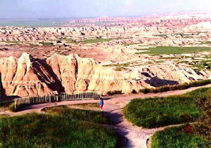
park in 1978, the 244,300-acre area preserves the sweep of prairie and the sublimity of massive rock formations.
The Lakota Sioux and other Plains Indians have long considered the the broad expanse of harsh terrain called the Badlands
a place of deep spiritual significance. The saw-tooth ridges and parched canyons inspired many generations of Native
Americans, especially young men who came on vision quests to pray for a good life enriched with fruitful hunting.
A vision quest would typically last four days and nights of fasting and sleep deprivation on a lonely hill. In
this life-changing test, a young brave would chant and meditate until an animal spirit came into vision and acted as a protector
for the rest of his life.
After this spiritual vision quest, the brave would return to his villiage where the elders could interpret the circumstances
surrounding his vision. Today, the Stronghold and Sheep Mountain Tables
are sacred sites for Lakota men to visit and pray and seek a vision for the future.
For about 11,000 years human beings have lived on the Badlands prairie. First
paleo-Indians, then Arikara Indians, and later the Oglala Sioux (or Lakota) populated the area. Carved by erosion, this scenic
landscape contains sharply eroded buttes, pinnacles, spires, and animal fossils that date back 40 million years.
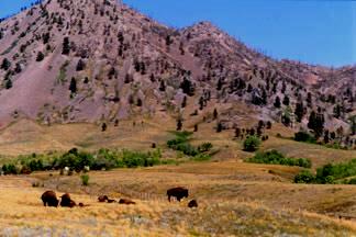
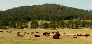
The Badlands includes the largest, protected mixed grass prairie in the United States which supports bison, bighorn
sheep, deer, and antelope. The Sage Creek Wilderness is the site of the reintroduction of the black-footed ferret, the most endangered land mammal in North America;
and the Stronghold Unit is co-managed with the Oglala Sioux Tribe and includes the sites of 1890's Ghost Dances.
This park can be divided into three main areas: the popular eastern finger of the North Unit, the Sage Creek Wilderness
Area, and the Pine Ridge Reservation section, or Stronghold Unit.
A visit to Sheep Mountain Table will reward the visitor with one
of Badlands National Park's most outstanding vistas. This 4 mile long plateau
is surrounded by steep drop offs and is accessible by a 7 mile dirt road which is passable only when dry. Because this is
a sacred place for the Lakota people, there are many prayer offerings and ceremonial artifacts.
Mako Sica (Land Bad) is the Indian term for the The Badlands National Park. To the tribes who vewntured
into this forbidding terrain at the "edge of the world," the Badlands offered an unusual environment for individual vision
quests and group ceremonies.
The Plains Indians would find profound spiritual meaning in the harsh conditions, enabling them to communicate directly
with the Great Spirit. Several famous Nativer American ceremonies took place in the Badlands including the enigmatic
"Ghost Dance" of the Ogala Dakota.
The oral histories of the Plains Indians speak about the legends of the dinosaurs, the visious monsters and giant winged
beast. that roamed the land before the coming of the white people.
One popular legend speaks about a winged beast called Wakinyan Tanka, the great thunderbird of the Black Hills. The
thunderbird fights against the dreaded water creature, Unktehi. The thunderbird uses lightning bolts to defeat
his enemies in the Badlands where "their bones were turned to rock."
BADLANDS
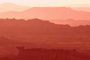
PANORAMA VIEW
|
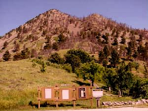
Bear Butte-- Black Hills, SD
Bear Butte State Park, SD
Bison Herds in Black Hills, SD
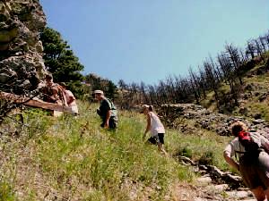
Bear Butte Hiking Trail
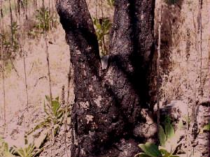
Ceremonial Prayer Rock in Tree
Harney Peak, SD
|
BEAR BUTTE, SOUT DAKOTA
The Western part of South Dakota is a revered gateway between the Black Hills and the vast open prairie. At one
time millions of bison roamed the prairie and provided sustenance to the Native Americans. The buffalo was the most
sacred animal to the tribes of the Central Plains. Every part of the animal was untilized from the meat for protein,
blood for paints, hide for clothes, hoofs for glue, bones for tools, organs for containers.
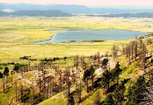
The Black Hills or Pah Sepa means "Hills of Black" are a rugged mountain
range spanning western South Dakota and northeast Wyoming. These mountains receive their name from the dark Ponderosa
Pine covered hills that rise on the treeless prairies.
Roughly enclosed by the Belle Fourche & Cheyenne Rivers, The Black Hills encompass over 6000 square miles.
Geologists studies show these peaks were once over 14,000 feet but have been reduced to half the height.
The Plains Indians worshiped and revered the Black hills for hundreds of years. Bear Butte was used for vision
quests and Hannet Peak was a legendary mystic location. When gold was discovered in the Black Hills in 1868 by an expedition
led by General Custer, the resulting gold ruch drove out the indigenous native population.
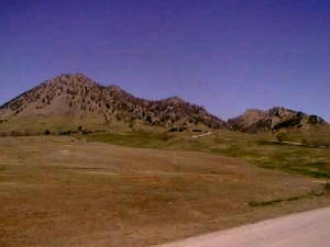
Bear Butte is a high range in the northwest corner of the Black Hills resembling a huge sleeping bear. The Sioux named
this peak Mato Pah meaning Sleeping Bear Mountain; Cheyenne named it Noahavose meaning the Good Mountain; Lakota named
it Pahan Wakan meaninhg Bear Mountain. This stand-alone butte was a powerful sacred site used for vision quests that
was used by the Plains Indians for many millennia.
Vision quests are tests where the individual searches for spiritual power and self-knowledge. The bear has a
strong symbolic meaning to the Naticve Americans symbolic of hibernation and dreaming.
It was on Bear Butte that the Lakota warior Crazy Horse had his famous vision for the future of all Indians would experience
hard times ahead, yet would eventually arrive at a period of sopiritual awakening and peace on earth. Sitting Bull and
Crazy Horse unified the Lakota and Cheyenne in their victorious battle at Little Big Horn, Montana where Custer and the 7th
Cavalry were wiped out.
In the Cheyene tradition, Bear Butte is famous for a cave where Sweet Medicine spent 4 years on a vision quest.
In the cave, Sweet Medicine met the god Maheo who bestowed upon him the 4 taboos-- murder, incest, adultry and theft.
this was given in 4 arrowheads that would bless and protect the Cheyenne in which they beelived they were the chosen people.
Every year 4000 Native Americans come to pray and do ceremonies on Bear Butte. There is an area at the base of the mountain
for Native American to practice pipe ceremony, sweat lodges and drumming rituals.
Harney Peak is the tallest peak of the Black Hills and the highest peak east of the Rocky Mountains. The mountain is a beacon
with commanding views of the surrounding region.
To the Ogala and Lakota, Harney Peak has always been a mythical
mountain as passed down from oral histories. A long tradition of praying on the mountain and recounting visions make
the peak renowned to all who live in its shadow.
At the age of 9. a soon-to-be prominent medicine man of the Ogala people named Black Elk had a profound vision at the
peak. Black Elk was led by his spiritual guides to the summit who showed him that Harney Peak was located at he exact
center of the world. For him, it was a place of spiritual rejuvenation where he could commune with his ancestors.
In another vision Black was shown good and evil from the center of a stone circle indicating the four directions.
Bear Butte Mountain and Bear Butte Lake
|
Gobbler Pass,
Wind Cave Nat'l Park, SD
Limestone Cliff, Wind Cave Nat'l Park
Ponderosa Pines, Wind Cave Nat'l Park
Bison Flats, Wind Cave Nat'l Park, SD
Cave Mouth (Equalized Pressure Sound)
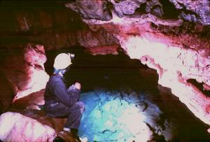
Wind Cave, SD (Inside The Entrance)
|
CAVE WIND, SOUTH DAKOTA
The Western part of South Dakota is a revered gateway between the Black Hills and the vast open prairie. At one
time millions of bison roamed the prairie and provided sustenance to the Native Americans. The buffalo was the most
sacred animal to the tribes of the Central Plains. Every part of the animal was untilized from the meat for protein,
blood for paints, hide for clothes, hoofs for glue, bones for tools, organs for containers.
Wind Cave National Park is located in the very south of the Black Hills region
of western South Dakota. Covering almost 30,000 acres in the Black Hills. This national park features acres of rolling mountains,
ponderosa forests, preserved prairie, ravines, limestone caverns, deep caves, pine forests
and hills. Its characteristics are typical of several regions where southwestern
yucca and cactus exist side-by-side with eastern burr oak and elm.
The park's mixed grass prairie is one of the few remaining and is home
to native wildlife such as bison herds, elk, pronghorn, mule deer, coyotes, and prairie dog communities as well
as nuthatches, wild turkeys, meadowlarks
and prairie falcons.
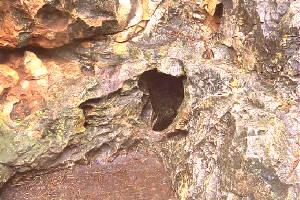
Wind Cave National Park gets it name from the winds that blow alternately in and out of the mouth of Wind Cave caused by changes in atmospheric pressure. It is one of the world's longest and most complex
caves with more than 87 miles of passageways
to date, which makes Wind Cave the fifth largest cave system in the United States
and eighth in the world.
The depths of Wind Cave are flooded with several large underground lakes. Calcite
Rafts, a thin layer of calcite stone, floats on the top of the lake. The unusual stone formation will sink when the
surface tension of the water is broken. These formations have been found in
dry parts of the cave, adding to the evidence that the water levels in the Black Hills have rose and receded over the millennium,
creating the numerous caves we can see today.
Wind Cave National Park protects the 87 mile labyrinth of passageways of Wind Cave.
Packed with crystals, chocolate-colored crystals, formations resembling faces or animals, underground formations and chambers, the cave is full of geologic wonders that
inspired names such as the "Garden of Eden" and the "Dungeon."
According to Sioux legend there is a sacred cave called Wind Cave in
Wind Cave National Park in the Black Hills that was the source of buffalo
herds that once roamed the plains in great numbers. A steady, constant wind from the inner reaches of the cave is said
to have blown the herds out from under the earth to feed the Lakota people.
The charms of the cave's 104 miles of explored passages are its colorful array of geological features, including the
world's most impressive display of "boxwork," a calcite formation resembling uneven honeycomb cells. It also features "popcorn"
and "frostwork" formations, but due to the relatively dry atmosphere, you won't find the familiar stalactites or stalagmites
that are typical of other caves. Considered to be the fourth-longest cave in
the U.S. and sixth-longest in the world, Wind Cave's known passages represent only five percent of its total size.
There are many stories and legends about this vast underground labyrinth passageways.
When entering deep inside this cave many people experience profound spiritual experiences that defy explanation. There have been base camps set up deep in cave explorations with workers have seen
and experienced supernatural phenomena.
It is well known that deep inside caves there are no photons so various types
of vortex energy fields from geological, astronomical and spiritual energies can create profound phenomena. This sacred cave is still much of a mystery with many undiscovered parts in its network of labyrinths. Some believe there is a vast tunnel system that goes all the way to Mount Shasta,
CA.
WIND CAVE NATIONAL PARK
|
|
|
|
|
|
|
|
|